To provide you with the best experience, cookies are used on this site. Find out more here.

To provide you with the best experience, cookies are used on this site. Find out more here.

To build your own Itinerary, click  to add an item to your Itinerary basket.
Already saved an Itinerary?


The National Cycle Network is a series of traffic-free paths and quiet, on-road cycling and walking routes,that connect to every major town and city.
A section of National Route 4 loosely follows the River Thames. It is also known as the Thames Valley Cycle Route and passes through Windsor Great Park.
National Route 61 starts near Maidenhead and follows the Jubilee River until the edge of London.
If you are travelling by bike to Windsor and the Royal Borough, take a look at cycle.travel. Simply pop in your 'from' and 'to' points and let it find you the best route on quiet lanes and cycleways.
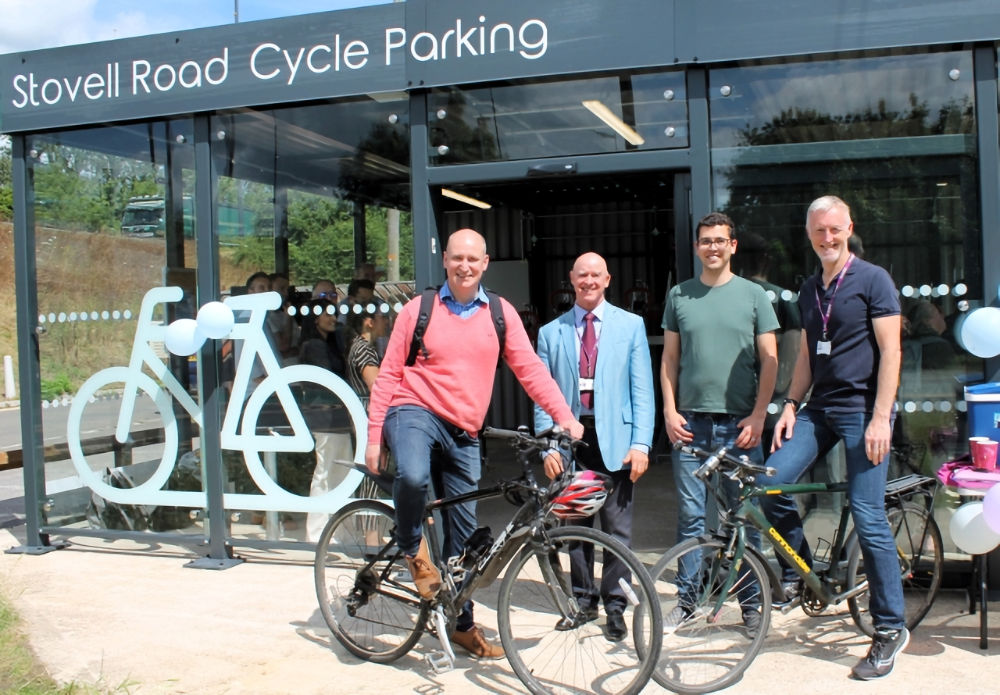
The Royal Borough has recently opened covered, access-controlled cycle parking to the public at Windsor Leisure Centre, perfect for visitors arriving by bike, including those cycling on National Cycle Network 4, which passes by the parking facility.
It’s completely enclosed with 36 spaces as two tier racks, Sheffield stands, cargo stands, a pump and repair stand, and lockers to store helmets and belongings.
Download the cycle security firm Spokesafe app then you can then book your space on arrival, or in advance. Entry is protected by keypad access for only registered, ID-verified users. The unit also includes 24/7 monitored CCTV and customer support from Spokesafe.
CycleStreets is a UK-wide cycle journey planner system, which lets you plan routes from A to B by bike. It is designed by cyclists, for cyclists, and caters for the needs of both confident and less confident cyclists.
National Trails' Thames Path enables you to follow the River Thames on its 184-mile journey from source to sea! Use the Thames Path to explore the beautiful and historic section of the River Thames that flows through the Royal Borough of Windsor and Maidenhead. Please note the Thames Path is a public footpath and is not suitable for cyclists.
Three Castles Path is a footpath route from Windsor to Winchester (via Ascot) based upon the 13th-century journeys of King John at the time of Magna Carta.
Ratings & Reviews
Powered By
![]()

In partnership with

© Royal Borough of Windsor and Maidenhead 2026. All Rights Reserved